2.6.4. OMA L4 (Athens Metro) Calculator
2.6.4.1. Overview
The OMA L4 calculator converts coordinates between the local grid of the Athens Metro Line 4 project (OMA, project CON-005/21 “Γραμμή 4 — Τμήμα A’, Άλσος Βεΐκου — Γουδή”), the Greek state grid EGSA’87 (EPSG:2100), and WGS84 latitude/longitude in three distinct flavours.
The tool is found under Calculations > Survey Calculator > OMA L4 (Athens Metro).
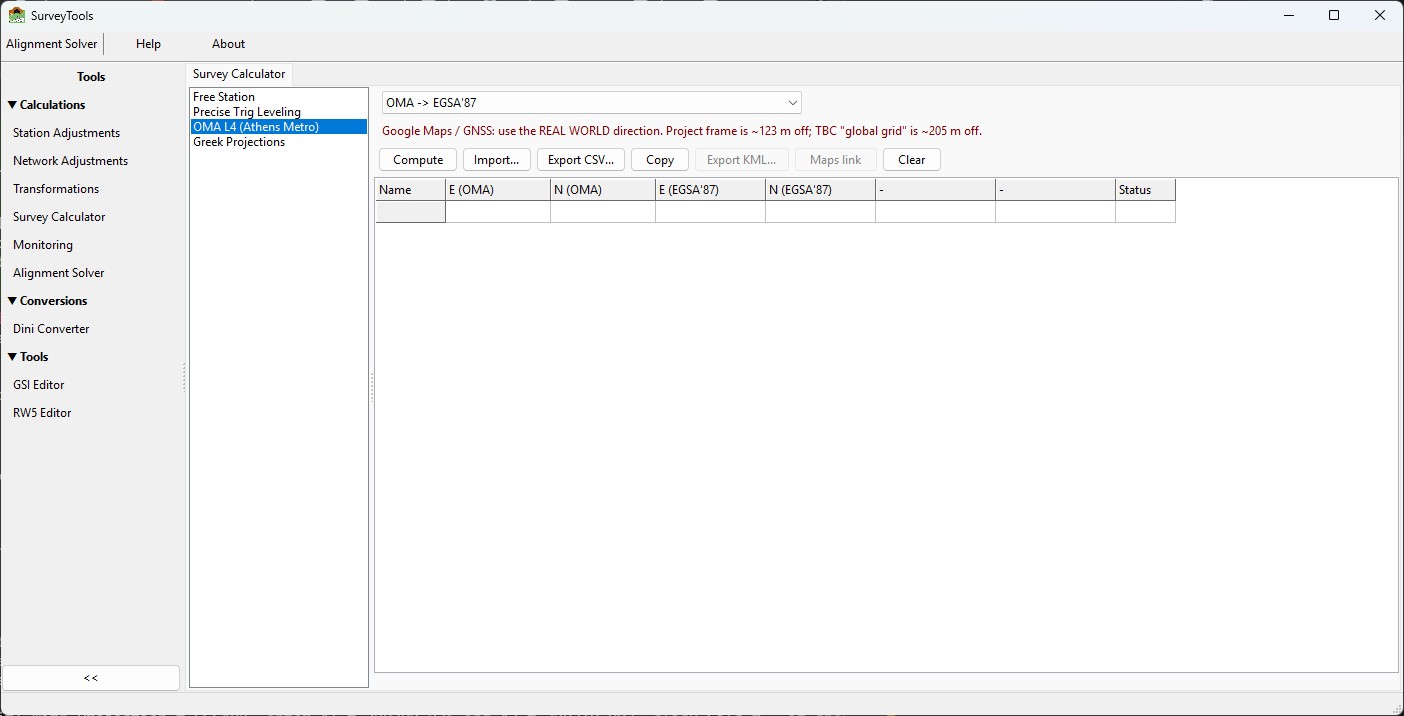
The OMA L4 (Athens Metro) calculator.
Every parameter in this calculator was derived from, and validated
against, the project’s published adjusted network (report
4GW0PW205R901A_, 11 primary control points, ~100 network points in
total). Grid-to-grid conversions reproduce the published tables at the
millimetre level; the real-world WGS84 output was verified to about one
metre against the network’s own GNSS (ECEF) positions.
Warning
The three WGS84 frames — read this first. In the Line 4 project three different things are called “WGS84”. They disagree by up to 200 metres on the ground:
Frame |
What it is |
Distance from real world |
|---|---|---|
Project WGS84 |
Bare inverse projection of the OMA grid. This is what TBC reports and the project’s coordinate tables print as “WGS84”. |
~123 m |
TBC “global grid” |
The project 7-parameter Helmert applied on top of the project frame. Reproduces TBC’s “global grid” printout. |
~205 m |
Real-world WGS84 |
OMA → EGSA’87 → official EPSG:1272 datum shift. This is the only frame that agrees with Google Maps, GNSS receivers and the network’s own adjusted ECEF positions. |
~0.9 m |
Use the project frame only to compare against project deliverables. Use the TBC frame only to reproduce TBC printouts. For anything that touches a map or a GNSS receiver, use REAL WORLD. The calculator enforces this: KML export and Google-Maps links are enabled only for the real-world direction.
Example — the same physical pillar (T10) in all three frames:
project frame:    37.99985584 N   23.78717579 E
TBC "global":     38.00232381 N   23.78844686 E
REAL WORLD:       38.00093975 N   23.78691125 E   <- Google Maps
2.6.4.2. Conversion directions
The direction dropdown offers seven conversions:
Direction |
Method |
Accuracy |
|---|---|---|
OMA → EGSA’87 |
2D similarity (4-parameter) |
2.6 mm RMS, 5.3 mm max |
EGSA’87 → OMA |
exact inverse similarity |
same |
OMA → WGS84 project frame |
inverse Transverse Mercator |
< 0.0001″ vs report |
WGS84 project frame → OMA |
forward Transverse Mercator |
same |
OMA → WGS84 REAL WORLD |
similarity + EGSA’87 + EPSG:1272 |
~0.9 m vs GNSS |
WGS84 real world → OMA |
inverse of the above chain |
same (round trip < 5 mm) |
OMA → WGS84 TBC “global grid” |
7-parameter Helmert (compatibility only) |
exact vs TBC printout |
2.6.4.3. Coordinate system definitions
Both grids are Transverse Mercator projections on the GRS80 ellipsoid (a = 6 378 137 m, 1/f = 298.257222101):
Parameter |
OMA |
EGSA’87 (EPSG:2100) |
|---|---|---|
Latitude of origin |
37° 58’ 30” N |
0° |
Central meridian |
23° 44’ 10” E |
24° E |
Scale factor k0 |
1.000 000 00 |
0.9996 |
False easting |
100 000 m |
500 000 m |
False northing |
100 000 m |
0 m |
Note
The TBC report prints the ellipsoid flattening truncated to
1/f = 298.257. The correct value is 298.257222101; using the
truncated one shifts EGSA’87 northings by about 17 mm. The calculator
uses the correct value.
2.6.4.4. OMA ↔ EGSA’87 similarity parameters
The two grids were produced by the same GPS network adjustment, so they are tied by a plane 4-parameter similarity (NOT by the official geodetic datum chain, which would leave 100–200 m of error). The parameters were derived by least squares on the 11 published primary control points (T10, T11N, T12N, T13N, T14N, T19N, T21, T25, T2N, T30, T5N):
E_egsa = 376648.19692628225 + 0.9996120081488511 * E_oma + 0.0004783049819259134 * N_oma
N_egsa = 4102982.5070791948 - 0.0004783049819259134 * E_oma + 0.9996120081488511 * N_oma

scale    = 0.9996121226  (-387.877 ppm)
rotation = +98.6958 arc-seconds, CLOCKWISE-positive convention
Fit quality: maximum residual 4.3 mm, RMS 2.3 mm on the 11 control points; maximum 5.3 mm over all ~100 network points (including points the fit never saw). The reverse direction is the exact algebraic inverse — no separate parameter set.
2.6.4.5. Real-world WGS84 chain
The REAL WORLD direction computes, in order:
OMA → EGSA’87 (similarity above);
EGSA’87 grid → GGRS87 geodetic coordinates (inverse Transverse Mercator);
geodetic → earth-centred cartesian (ECEF) on GRS80, h = 0;
the official GGRS87 → WGS84 datum shift EPSG:1272: ΔX = −199.87 m, ΔY = +74.79 m, ΔZ = +246.62 m;
ECEF → geodetic on the WGS84 ellipsoid.
Validation: the network report’s adjusted ECEF coordinates (the true GNSS positions of the points) agree with this chain to a constant 0.84–0.85 m with only ~1 cm spread across all points — that constant is the accuracy limit of the official Greek datum shift itself, not of the calculator.
Ellipsoidal height is deliberately not carried through the chain (horizontal-only tool). The effect on the horizontal result is at most ~1.6 mm.
2.6.4.6. TBC “global grid” parameters (compatibility only)
The project datum in Trimble Business Center carries this 7-parameter Helmert (“WGS84 → GRS80”, position-vector convention):
Tx = +200.4834 m     Rx = +0.108555"
Ty =  -33.5850 m     Ry = +0.049625"
Tz = -214.9593 m     Rz = +0.090870"
ds = -5.1814791222 ppm
Applying its exact inverse after the project-frame conversion reproduces TBC’s “global grid” values (e.g. T10 → 38.00232381 N, 23.78844686 E). That point is 204.7 m away from the pillar’s real position — this direction exists only so TBC printouts can be reproduced and checked.
2.6.4.7. Using the calculator
Open Calculations > Survey Calculator, pick OMA L4 (Athens Metro) from the list.
Choose the conversion direction from the dropdown. The grid’s input column captions follow the direction (grid metres or decimal degrees).
Enter points in the grid (Name, then the two input values), or click Import… to load a text/CSV file. Import accepts one point per line,
name x y, separated by comma, semicolon, tab or spaces; numbers use the decimal point; in semicolon- or tab-separated files the decimal comma is also accepted. Lines that do not parse are skipped.Click Compute. Result columns fill in; for geodetic outputs both decimal degrees (8 decimals) and DMS strings (
N37°59'59.48104") are shown. The Status column marks each rowok,bad inputorfailed.Output actions:
Export CSV… writes the whole grid to a CSV file.
Copy puts the grid on the clipboard (tab-separated — pastes straight into a spreadsheet).
Export KML… (REAL WORLD direction only) writes the computed points as a KML file for Google Earth / Google My Maps.
Maps link (REAL WORLD direction only) copies a
https://maps.google.com/?q=lat,lonlink for the selected row; double-clicking a computed row opens the link in the browser.
Switching direction clears the result columns (inputs are kept), so results from one frame can never be misread as another frame’s.
2.6.4.8. Worked examples
Control pillar T10 — OMA (104 485.145, 102 760.135):
OMA -> EGSA'87:            481141.953   4205652.796      (published: 481141.953  4205652.797)
OMA -> WGS84 project:      37.99985584  23.78717579      = N37°59'59.48102"  E23°47'13.83283"
OMA -> WGS84 REAL WORLD:   38.00093975  23.78691125      = N38°00'03.38311"  E23°47'12.88050"
OMA -> WGS84 TBC:          38.00232381  23.78844686      (matches the TBC printout exactly)
Benchmark B44 — OMA (103 041.094, 101 347.619):
OMA -> EGSA'87:            479697.787   4204241.519      (published: 479697.786  4204241.520)
OMA -> WGS84 REAL WORLD:   37.98818925  23.77050202
Reverse check — EGSA’87 (481 141.953, 4 205 652.797) → OMA gives (104 485.145, 102 760.136): the published OMA value within 1 mm.
2.6.4.9. Limitations
Horizontal coordinates only; heights are not transformed.
The parameters are specific to the Athens Metro Line 4 network (CON-005/21). Do not use this calculator for any other project’s local grid, even one also called “OMA”.
The real-world WGS84 accuracy (~0.9 m) is bounded by the official EPSG:1272 datum shift, not by the calculator; grid-to-grid results are millimetre-level.
2.6.4.10. References
Project network report
4GW0PW205R901A_(adjusted network, OMA / EGSA’87 / geodetic / ECEF tables).TBC coordinate-system report
OMA_Rotation(OMA definition and the TBC 7-parameter Helmert).J.P. Snyder, Map Projections — A Working Manual, USGS Professional Paper 1395 (Transverse Mercator equations).
EPSG:1272 — GGRS87 to WGS 84 (3-parameter geocentric translation).
Engine units:
iqcalc.geodesyandiqcalc.omain the IQcalc package (see the IQcalc transforms documentation).